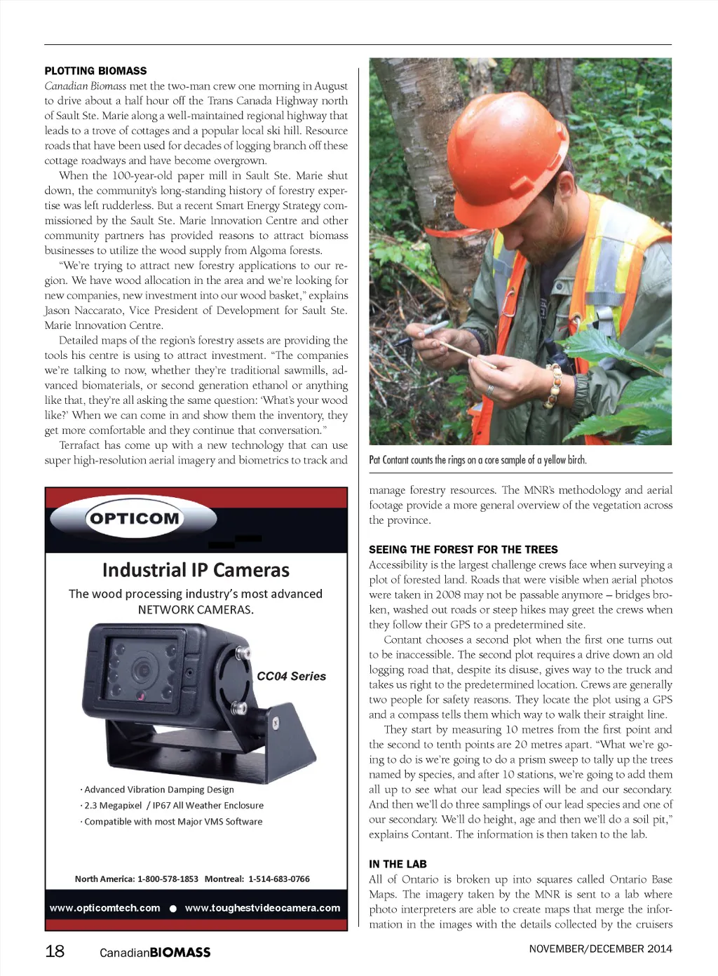
like Contant and Willoughby to give an accurate overview of the province’s land. “The ground work is of critical importance because you use that to calibrate the rest of our calls. Some areas you might have 10 or 15 plots in one map sheet, so that’s great – you have lot of things to go on, but in my case, I don’t have any plots in my area,” explains Ben MacKay, a photo interpreter who has been working with Wikwemikong for two years. There are large areas without any roads and the interpreters don’t have a secondary source with which to verify their work. Each interpreter is first trained as a cruiser doing surveys to get some experience on the ground. Ben started out as a forest technician with a diploma from Sault College where he learned timber cruising, mensuration skills, some silviculture and den-drology before taking a four-year forest management program from UBC. Some tree species are easy to identify – white pines tower above the forest with a distinctive star shape when viewed from above – but others require more thought. “North facing, south facing, what type of soils are there, what other species are grow-ing there, has there been disturbances like fire or management in the past, all those will help you make your call and describe your stand in an inventory.” The interpreters check their work against the field crew’s data. “This orange line is the 200-metre line that you walked,” MacKay tells me. He points to a drop-down menu that has information on when that plot was last harvested or planted. “There’s a whole bunch of information for that one plot. I can see what date they did it, who the cruisers were, the species composition, and it’s nice when they put in comments as well.” MacKay’s work joins that of the other photo interpreters in filling out a map of Ontario that can tell where deforestation or wildfire is occurring or be used to monitor the effects of climate change on forests and to develop predictions. In the Annual Report 2014, the Ministry of Natural Resources explains the importance of gathering this type of data for the for-est industry. “The more that is understood about how and why Canada’s forests are changing, the better prepared researchers and forest managers will be in adapting to all the other changes going on: in the forest products Canada turns out, in the global market demand for those products, and in the public expectations about what constitutes good forest stewardship,” the report reads. The MNR depends on satellite imagery to map out the coun-try’s forests and collaborate with international research partner-ships to monitor global forests. But satellite imagery has not made ground-and air-based data collection unnecessary. The ministry must depend on interpreters and “boots on the ground” to verify what the satellites are seeing and provide depth and context to the imagery. From satellites, to airplanes, and finally to the cruiser crush-ing the sand between two fingers, a deeper knowledge of our forests provides a comprehensive view of what’s happening in different regions. The applications for the data, however, are in the eye of the beholder. • Accurate, while you wait, Biomass Measurement Moisture Measurement & Control OnLine Near Infrared Moisture Sensors The ability to quickly and accurately know the moisture content of a biomass shipment when it arrives for delivery is a key advantage to both buyer and supplier. Insuring accurate agreement on valve and price and the buyers ability to refuse delivery. • Raw material optimisation for burning efficiency • Suppliers and deliveries control for stock management and cost optimisation. Instant Accurate OnLine Moisture Monitoring for Biomass Applications 941.351.7870 +47 934 68 072 • www.prediktor.no Canadian BIOMASS 19
Canadian Biomass November - December 2014: Page 19