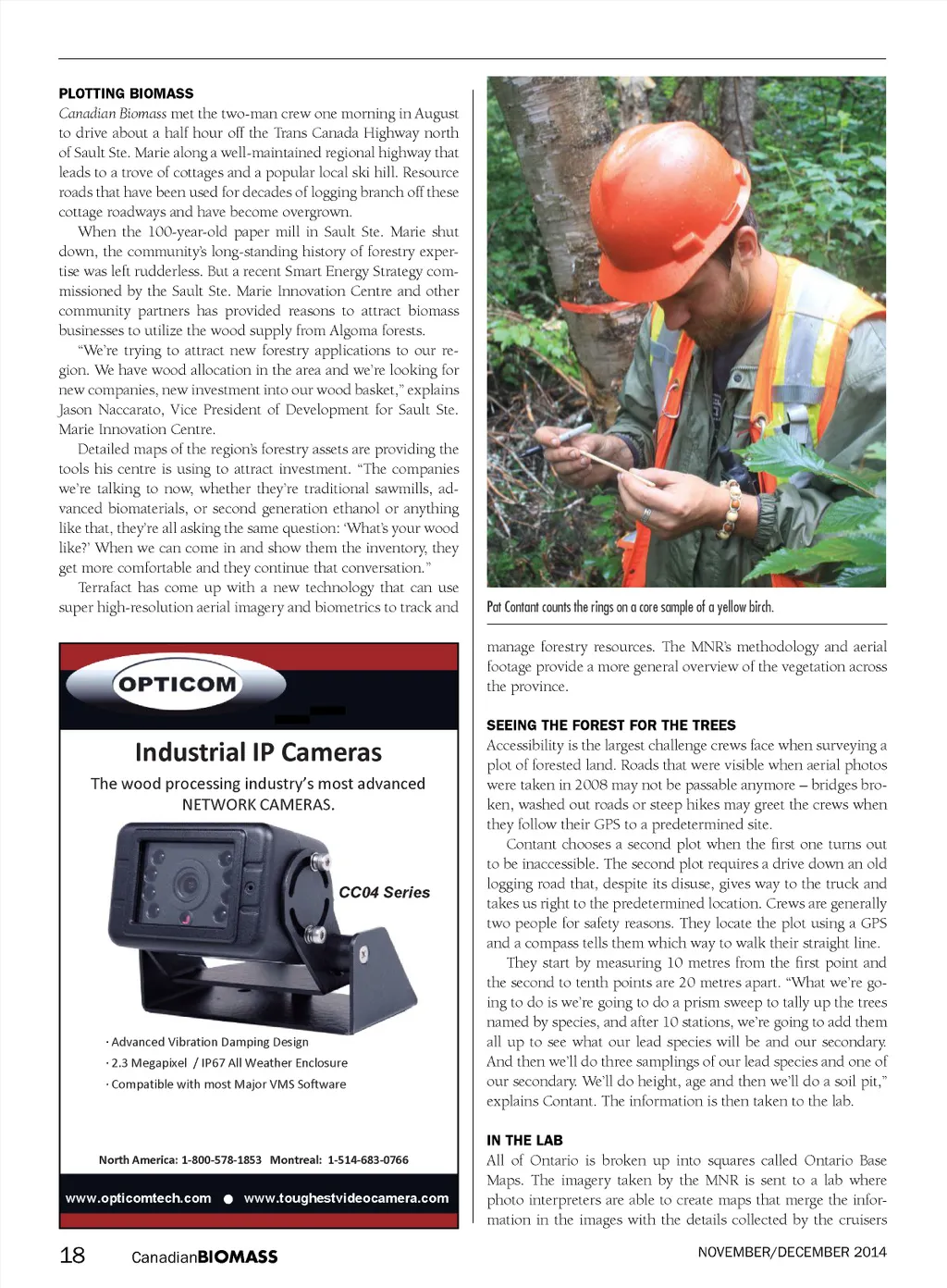
PLOTTING BIOMASS Canadian Biomass met the two-man crew one morning in August to drive about a half hour off the Trans Canada Highway north of Sault Ste. Marie along a well-maintained regional highway that leads to a trove of cottages and a popular local ski hill. Resource roads that have been used for decades of logging branch off these cottage roadways and have become overgrown. When the 100-year-old paper mill in Sault Ste. Marie shut down, the community’s long-standing history of forestry exper-tise was left rudderless. But a recent Smart Energy Strategy com-missioned by the Sault Ste. Marie Innovation Centre and other community partners has provided reasons to attract biomass businesses to utilize the wood supply from Algoma forests. “We’re trying to attract new forestry applications to our re-gion. We have wood allocation in the area and we’re looking for new companies, new investment into our wood basket,” explains Jason Naccarato, Vice President of Development for Sault Ste. Marie Innovation Centre. Detailed maps of the region’s forestry assets are providing the tools his centre is using to attract investment. “The companies we’re talking to now, whether they’re traditional sawmills, ad-vanced biomaterials, or second generation ethanol or anything like that, they’re all asking the same question: ‘What’s your wood like?’ When we can come in and show them the inventory, they get more comfortable and they continue that conversation.” Terrafact has come up with a new technology that can use super high-resolution aerial imagery and biometrics to track and Pat Contant counts the rings on a core sample of a yellow birch. manage forestry resources. The MNR’s methodology and aerial footage provide a more general overview of the vegetation across the province. Industrial IP Cameras The wood processing industry’s most advanced NETWORK CAMERAS. SEEING THE FOREST FOR THE TREES CC04 Series · Advanced Vibration Damping Design · 2.3 Megapixel / IP67 All Weather Enclosure · Compatible with most Major VMS Software Accessibility is the largest challenge crews face when surveying a plot of forested land. Roads that were visible when aerial photos were taken in 2008 may not be passable anymore – bridges bro-ken, washed out roads or steep hikes may greet the crews when they follow their GPS to a predetermined site. Contant chooses a second plot when the first one turns out to be inaccessible. The second plot requires a drive down an old logging road that, despite its disuse, gives way to the truck and takes us right to the predetermined location. Crews are generally two people for safety reasons. They locate the plot using a GPS and a compass tells them which way to walk their straight line. They start by measuring 10 metres from the first point and the second to tenth points are 20 metres apart. “What we’re go-ing to do is we’re going to do a prism sweep to tally up the trees named by species, and after 10 stations, we’re going to add them all up to see what our lead species will be and our secondary. And then we’ll do three samplings of our lead species and one of our secondary. We’ll do height, age and then we’ll do a soil pit,” explains Contant. The information is then taken to the lab. IN THE LAB North America: 1-800-578-1853 Montreal: 1-514-683-0766 www.opticomtech.com www.toughestvideocamera.com All of Ontario is broken up into squares called Ontario Base Maps. The imagery taken by the MNR is sent to a lab where photo interpreters are able to create maps that merge the infor-mation in the images with the details collected by the cruisers NOVEMBER/DECEMBER 2014 18 Canadian BIOMASS
Canadian Biomass November - December 2014: Page 18